The information comes directly from their site, and data were obtained mostly by using remote sensing data from MODIS. In fact, The Flood Observatory uses orbital remote sensing to detect, measure, and map surface water changes. It includes:
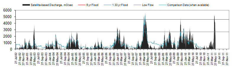
1- River Watch, an experimental satellite-based river discharge measurement system (example).
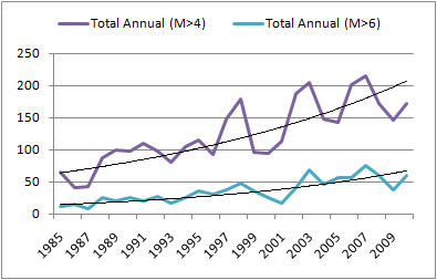
3 - Active Archive of Large Floods, 1985 to present (listing and characterization of large flood events).
4 - Rapid Response Inundation Maps, for individual flood events.
No comments:
Post a Comment